Here I share my recent trip to Tongariro and beyond.
I recently finished a month-long trip on the South Island, where I hiked (“tramped”) around many of New Zealand’s beautiful wilderness areas. It was beautiful, and hard, and I lost my phone somewhere in Arthur’s Pass, forcing me to get by with only an old-school $30 prepaid cell phone and a paper map. While often inconvenient, traveling in that early-2000’s style is, I found, extremely liberating. Many of the features that smartphones offer are not things that you really want (emails, Instagram reels, spam texts) and I was more than happy to do without for a little while. I hitchhiked across most of the South Island without any real problems.
Almost immediately upon returning to Wellington and getting a new phone, any tranquility that I had found during my few weeks of freedom was washed away and I felt like I was going completely insane. I figured the only reasonable move was to plan another adventure.
And so I spent a few days sorting out the details for a big North Island tramp. I settled on something in Tongariro National Park – a vast volcanic landscape with plenty to explore, and a land with great spiritual value to Māori, specifically Ngāti Tūwharetoa. I’d attempted and failed the classic Northern Circuit with my sister back in 2019 – due to horrific weather, we turned back before the main crossing, and I figured it was worth another shot.
This time around I wanted something bigger, and the forecast was good enough to permit a more adventurous approach. I put together a six-day route which would start with wild camping at Tama Lakes, then zip through the Northern Circuit leg and continue on to the more remote Round the Mountain track. It would be a challenging but doable journey through an incredible volcanic landscape, with a good mix of camping and more comfortable hut nights.
Thoroughly excited with my plan, I set off from Wellington on a damp Sunday morning, hopping on the train to Waikanae and hitching from there. No more than a minute of waiting on the main road out of town and I was on my way. In no time I had made it to Bulls, where I was picked up by a nice fellow who works in forensics for NZ police. He proceeded to give me a sort of true crime tour of the New Zealand countryside, explaining where, in the quaint country towns along the highway, gruesome (and recent) murders had taken place. If he wasn’t so friendly this might’ve been a little offputting.
He dropped me off in some depressing roadside town, where it had begun to rain heavily. I got out my rain jacket and walked down to the roundabout. This was the last little leg to the national park, and there was concerningly little traffic heading my way. Still, it only took about fifteen minutes for someone to pull over, a middle aged man in a station wagon. He said he was driving almost exactly where I was headed, so I gladly jumped in, out of the rain. I had the unmistakable sense that I recognized him from somewhere, but I couldn’t immediately place it. I hardly know anyone in New Zealand, so it was a strange feeling, until it dawned on me that he was the guy from the geology youtube videos that I had been watching obsessively since the previous week. He seemed pleased and a bit surprised that I recognized him from YouTube. I felt like I was meeting a celebrity. They really are good videos and I would recommend anyone watch them. They make geology fun.
I told him my plan for Tongariro and he effectively said that my route sounded like no fun at all, and suggested, having himself been over nearly every square inch of the park over the years, a much more exciting route that I would have never considered:
Starting at Whakapapa village, walk to Mangatepopo Hut and climb up to Hardman’s Ridge, following the ridge to Mt Tongariro, then sidle around the mountain until you reach a nice plateau. From here you can see the rim of the North Crater. Head up and over the crater rim, dropping into the crater floor, which, being a former lava lake, is almost completely flat and offers great opportunities for camping.
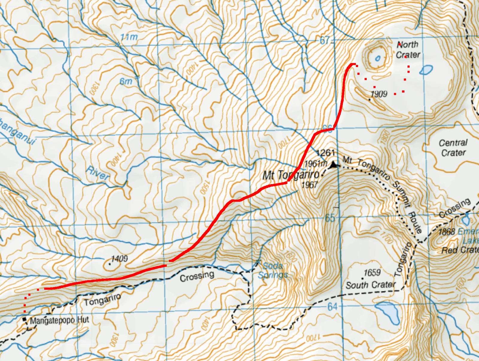
This did indeed sound way better than what I had planned. It hadn’t occurred to me at all that you could camp in the crater or anywhere else near the main crossing track. For context, the Tongariro Alpine Crossing, which this route briefly joins, is one of New Zealand’s most popular (if not the most popular) day walks, and can see over 3000 people walking over in a single day. It is also the site of countless rescues every year, and a handful of deaths, mainly the result of unprepared tourists taking off into an alpine environment in terrible weather with little preparation. The rest of the park, requiring a bit of off-track knowhow, remains largely unexplored.
After considering the risks (being bad at navigation and getting lost in the wilderness, sliding down the side of a a volcano, becoming hypothermic while camped out on an exposed mountain by myself), I decided that it was actually a very doable mission: straightforward navigation, a perfect forecast, many back-out options should anything go amiss, and all on the foundation of strong advice from a very experienced outdoorsman.
I made it to Whakapapa Village that evening and spent a cold and rainy night camped out at the holiday park. I shared dinner with two lovely older couples and went off to bed early. In the terrible weather, there wasn’t the slightest hint of any distant mountains that evening, but by the morning the cloud had cleared and revealed Ruapehu with a fresh coat of snow.
I was mildly concerned that the previous night’s snow might have made my route impassable, so I stopped by the visitor’s center as soon as it opened at 8am. I asked about the Tongariro Summit route marked on the topo map, and he responded sternly:
“You should absolutely not try it, unless you are an experienced mountaineer, as it will be snowy, icy, and very dangerous after the storm.”
I’ve been getting better at interpreting DOC advice. In my experience, some DOC workers will instantly assume that you are the dumbest, worst prepared tourist imaginable and tailor their advice accordingly. I essentially ignored his advice – I may be a dumb and underprepared tourist, but I figured that I could proceed with my plan and turn back or camp out if things got icy.
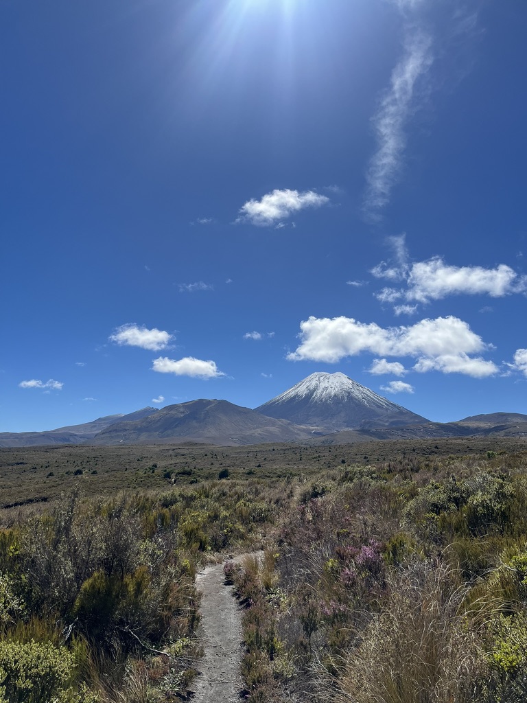
So I set off shortly after on the very deeply eroded Mangatepopo track in clear and crisp weather. It is a lovely little walk to Mangatepopo Hut, with excellent views of Ngāuruhoe and delightful alpine plants – snow totara, (invasive) heather, and tussock. The track is surprisingly rough for a Great Walk, and I slipped in the muddy trenches a couple of times.
I arrived at Mangatepopo Hut at about 11:30 am, a bit later than I had planned. It was surprisingly hot – there was almost no cover on the track – and I wasn’t sure if I had another four or five hours of walking in me. Plus, with a tent, six days of food, and 3 liters of water, my pack was feeling very heavy. But stopping so early in the day sounded boring and lame, so after a nice long lunch break at the hut I continued on to look for the way to North Crater.
Maybe 10 minutes of walking past the hut, I spotted what looked like a rough track on the left heading up to the ridge. This was surely the way up. I left the main track, hopped over the stream, and scrambled up, noting that I should look for campsites along the way should anything go awry. After a few minutes the path totally fell off. This was maybe not a track after all, but the way up was clear enough. I carried on, walking very steeply straight up to the ridge. 30 minutes or so in, to my pleasant surprise, I encountered a very fit looking couple carrying daypacks. They said they had done a loop to the red Red Crater, having sidled around Tongariro. I asked them about snow and ice and they said there was none at all. Yay! They wished me luck and carried on.
I soon found myself on the Hardman’s Ridge, with a beautiful view and not a soul in sight, aside from the steady stream down on the main track. It was getting quite late, already 3pm, but I was feeling optimistic – the couple had successfully done a similar route, and the view from the bridge revealed many suitable camping sites should I get caught out.
I continued along the ridge, and to my delight, encountered a cairn:

I was now undoubtedly on the right track, with plenty of daylight hours to spare. And what a stunning view.
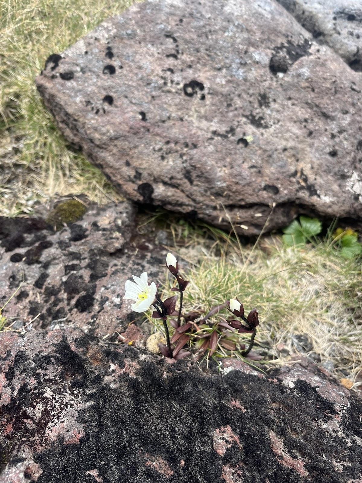
Gentianella bellidifolia
Now in great spirits I continued along the ridge until I found myself on the side of Tongariro. Instead of sidling as planned I went straight up and over – surprisingly easygoing. It was bone-dry aside from a few tiny pockets of snow – quite a contrast to the DOC ranger’s prediction!
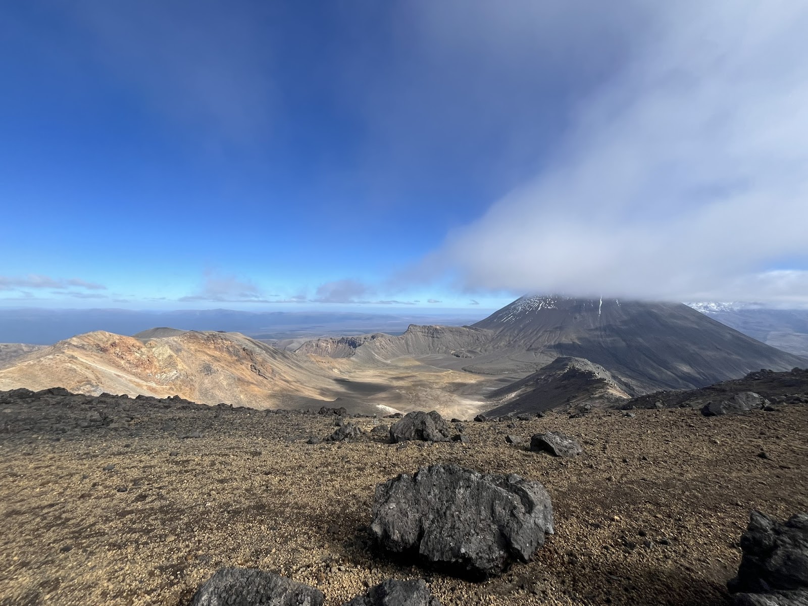
My pack was feeling heavy and my feet were very sore. The sight north to the Crater Rim kept me going. It was so beautiful out there and I had it all to myself.
I trudged along, through the wide plateau before the crater and went up along the crater rim, aiming for the left of Pt1909. Soon I was up on the rim with a clear view of the crater and the deep explosion pit. I finally had eyes on my campsite for the night.
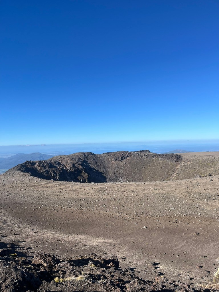
Quite surreal to be out here on my own in this deserted moonscape. A few thousand years ago this would have been a ‘seething and sputtering’ lava lake – now settled and cooled to make a lovely flat camping ground.
Incredibly, but unsurprisingly, no one else had decided to get out here on this long holiday weekend. I set out for the northeast corner, hoping to find a spot with a good view of the sunrise. Having now hiked about 9 hours, I was more than ready to settle in for the night.
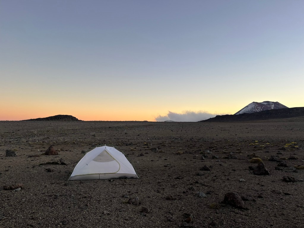
I found a suitaibly flat spot and set up camp. Glad to at last set down my heavy pack, I explored the crater a bit before dinner.
I climbed up over the northern edge of the rim to see what I could see. Ketetahi springs made quite a show, and lent a very pungent sulfur smell to the air.
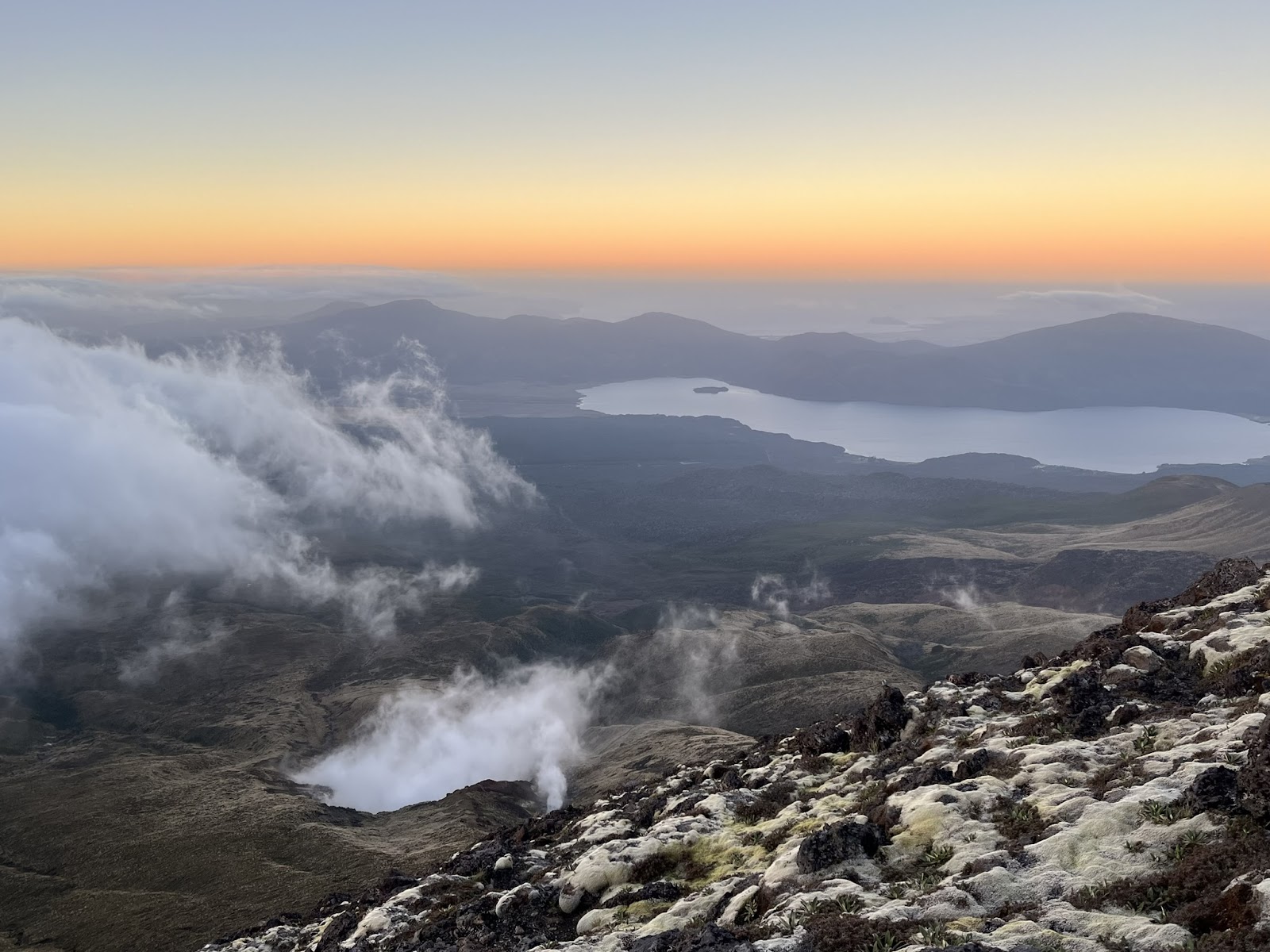
I wondered if there was anyone else on the mountain. Most day trippers would surely be gone by now, and I had seen no sign of any other walkers for the past 4 hours.
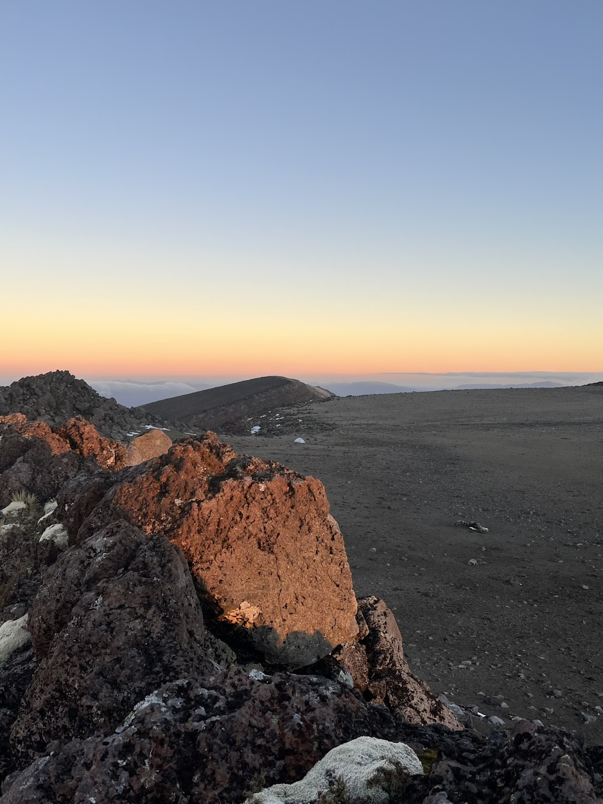
The westerly winds were picking up, and I settled into my tent for the night. I was pleased to have actually carried out the route I planned. Come nightfall, the winds were howling and the temperature dropped considerably. It is an odd place in the day, and a very eerie place at night. Through my tent door I could see the shape of the milky way. I was ready for morning to come, and soon enough I woke up to the sunrise.
I had breakfast and set off out of the crater and back towards Tongariro. At the plateau I saw two tiny figures making their way towards me. They were too far away to say hi but it was comforting seeing some other human beings.
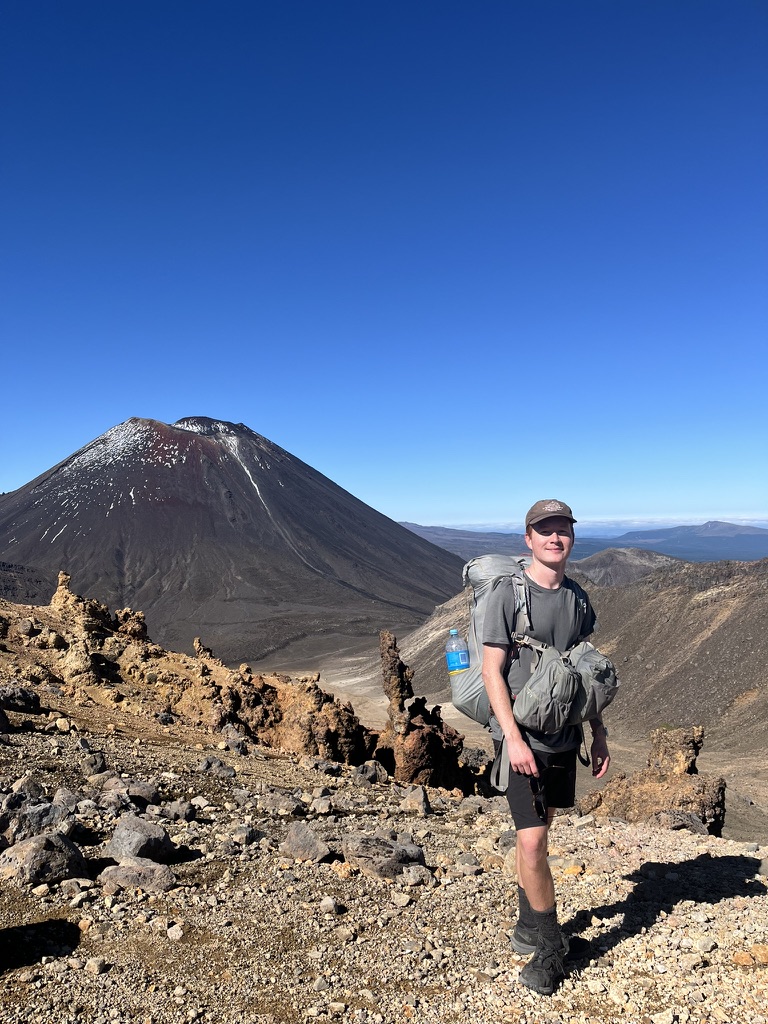
From the summit of Tongariro I could see the main Tongariro Crossing track. I sat and enjoyed the view, and was soon joined by a young guy who’d taken a detour from the Tongariro Crossing. He said he was very glad to see someone else taking on the summit, as his partner had stayed back and warned him that it might be too dangerous. It’s strange – in good weather, it is a perfectly easy route with incredible views. I guess the DOC warnings and the lack of signage keep most people out.

We chatted for a bit and he got a picture of me with Ngāuruhoe and my swag new Aarn pack.
With some apprehension I descended from the summit to join the main Tongariro crossing track. I could already see the throngs of day walkers, and I knew the more adventurous leg of my trip was over. Luckily the crossing is exceptionally beautiful, even with a crowd.
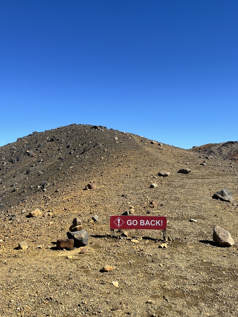
Just before rejoining the main track, I saw a sign. There was nothing written on it on my side, so it must be targeted at day walkers. Looking around to the other side, I was greeted with this stern warning. And, confusingly, an untoppled cairn. Somewhat comical given the ease of the track. Sometimes DOC is a little heavy handed.
I was quickly at what is probably the most striking part of the crossing, and accordingly it had an incredible number of visitors. A bit jarring after a day of solitude.
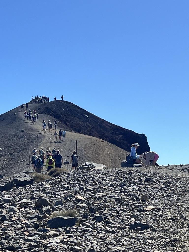
And funnily enough, this section of the track was sketchier than anything I had done off-track to get there. It’s a steep, scree covered slope with considerable drop offs on either side, and the path has been worn bare so that it’s quite slippery.

Despite the crowds, I enjoyed the view, but didn’t linger, and soon found myself at the turn off to Oturere hut. Almost immediately I was on my own again, and saw only a handful of people before I reached the hut.

A few hours walk through Oturere Valley and I arrived at Oturere Hut. I was very glad to have some fresh water and shade. I was officially back on the beaten track. One fellow American tourist even found he had cell service and was kind enough to share his conversation with the rest of the hut.
Thus concludes the more exciting part of my Tongariro adventure. From there I went on to camp at Tama Lakes, and cut my Tongariro trip short to take on Taranaki (blog post coming – stay tuned).

Leave a reply to Tristan Streichenberger Cancel reply